TURKEY

Turkey! Settled early in man's history, the country was to us an exciting mixture of modern and ancient. Turkey is a large country--800 miles across, perhaps more, and as diverse as any country in the world. We could easily have expended months there; we had six days. That meant we could only hit the high spots of Istanbul and the Aegean coast, but believe me, that was almost more than we could take in!
It was Friday, March 21, 2008, when Matt and Cindy left Michigan and the snow was already starting to fall heavily under a near-blizzard warning. Worried, we left early, encountering no problems weather or traffic related all the way to Chicago O'Hare airport. Unfortunately, the storm was still a factor, and we missed our connecting flight at London Heathrow, causing a delay in our arriving at Ataturk Airport in Istanbul.  Tired after our 20-or-so hour trip, we caught the modern Metro into the historic heart of the city, hailed a cab, and arrived at our very nice hotel by about 10pm local (Z+2) time Saturday night. Interesting sight along the way was a portion of the old city wall that once protected the city from invasion along the Sea of Marmara, the  major waterway connected to the Black Sea by the Bosphorus Straight, as well as the Sea itself.  
Saturday we woke in Istanbul! Byzantintium. Constantinople. Istanbul. All the same amazing city (think Manahattan at rush hour...all the time).
Our hotel was the Muhlis Bey, a very nice Ottoman style building, located no more than a city block from either Haghia Sofia or the Blue Mosque.  It had two terraces for breakfast, the topmost of which gave breathtaking views of both landmarks!
We made a friend there named Ali, a friendly young man at the front desk who explained a great deal of daily Moslem life to us.
The Muhlis Bey Oteli  served a traditional Turkish breakfast every morning of cucumbers, tomatos, fresh bread and jam, olives, and cheese. My only regret?  Obviously, good coffee is not a tradition for breakfast in Turkey; only instant Nescafe was available. To an American, this was a tough one to get through, but it was the same with every hotel we were at.
The showers were interesting: The shower head is set into the wall of a niche, with the water running onto the tiled floor into a drain near the toilet. Everything  tended to get a bit damp without a proper shower or shower curtain, but it was not much of a problem. I was only too glad to see good old 'western' style plumbing!  Those Turkish toilets were a bit much!

Oh, I nearly forgot...the muezzin. A muezzin calls out the summons to prayer five times a day...starting at sunrise. That's 6am in March.


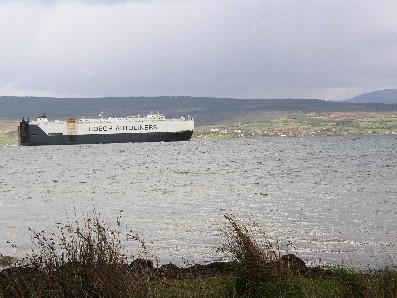
To the left is a shot that Matt took from the uppermost breakfast terrace. It shows a large freighter sailing up the Bosphorus Straight from the Sea of Marmara to the Black Sea. The Bosphorus Straight divides the European half of Istanbul from the Asian half (you are looking toward Asia in this picture).

Below are two amazing pictures.  The first is Haighia Sofia, the second the Blue Mosque.  More about both later.
(Note: all three pics are thumbnails. For truly awesome views, click on them for a larger look.)
Sunday
We started with a stroll north from the hotel looking for the main entrance to Haghia (Aya [Saint]) Sofia mosque/museum and basically enjoying the scenery.  Sultanahmet is the original city of Byzantium (established in the 7th century BC) that reached its peak under Justinian in the 6th century AD. The Ottoman Empire began its major march in the 13th century and lasted for centuries.  It was replaced with the Turkish Republic under the famous and able leadership of Mustafa kemal (Ataturk) in 1922.

One thing we noticed immediately was that Istanbul--all of Turkey that we saw--was a haven for cats!  There were cats roaming every street and alley, stray and pet since the country tends to allow pets to wander freely.  There were cats in every city we visited. Interestingly, all seemed relatively healthy. Fed by tourists or locals, we didn't see any in distress, for which we were grateful.

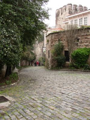
This is a picture of the beautiful street Alemdar Caddesi, which runs between Topkapi Palace on Seraglio Point, and the rear of Aya Sofia.
(Click on the thumbnail for a larger view)
It was Justinian who began construction of Haghia Sofia (the "Church of Holy Wisdom") over two earlier churches, and inaugurated it in 537 AD. The basilica is over 1,400 years old, and was the largest structure in the world for over 1,000 years. The Ottomans converted it from basilica into a mosque in the 15th century, and the minarets date from that period. It is now a museum.                                                                                                                               
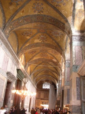
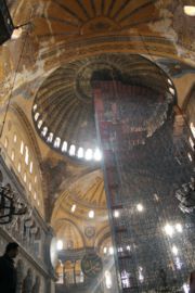
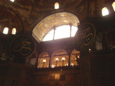
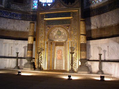
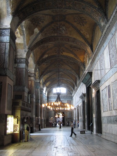
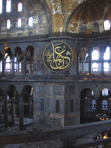
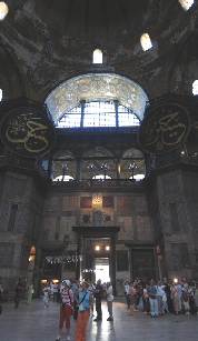
You enter Haghia Sofia through the outer vestibule, a long corridor with multiple entrances into the nave. At one end is a long, circular ramp leading to the gallery. Entering the nave is an awe-inspiring experience.  The dome rises to a dizzying height fro of 182 ft 5 in, a little smaller than the dome of the Pantheon. giant medallions with arabic script decorate the interior of the great chamber, and light streams in from several windows. The mihrab  occupies the center of one wall, it's decorated niche pointing the way to Mecca and thus showing which direction to pray.

(click on the thumbnails for a larger picture)
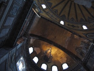
The vestibule (nathex). The dome: the first is an internet picture and the second was taken from directly below. Large window at the front of the church The Mihrab is in the direction of Mecca.
   The interior of the dome undergoing restoration      
An internet pic of the nathex (vestibule) 

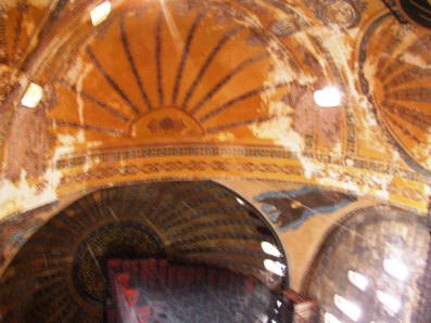
Two views of the dome in the apse. The first is an internet copy, the second taken on our visit. Each show a mosaic of the Virgin Mary holding the baby Jesus. They date to the year 867.

Another internet pic of the apse with the great medallions.  A final pic of the nave taken from the internet. 
         
 
This mosaic is located over the entry in the vestibule. It is of Christ on a throne with an emperor kneeling beside him. It has been dated to about 900AD.
 
Viking grafitti (Really!) Found in the galleries
Follow the old and worn circular ramp off the vestibule upstairs to the galleries. The galleries offer spectacular views into the main chamber as well as impressive examples of Byzantine art. You enter the south gallery by passing through the"Gatesof Heaven and Hell," a marble doorway. There you will find the "Deesis Mosaic, showing the Jesus, flanked by John the Baptist and the Virgin Mary. Next, you come to a mosaic of the Virgin holding Jesus, with Emperor John II Comnenus and  empress Irene on either side. The third south gallery is a mosaic of Christ, with Emperor Constantine IX Monomachus and Empress Zoe.
The Deesis Mosaic, showing the Jesus, flanked by John the Baptist and the Virgin Mary  The Comnenos Mosaic shows the Virgin holding Jesus, with Emperor John II Comnenus and  empress Irene  

Christ, with Emperor Constantine IX Monomachus and Empress Zoe. Above the emperor's head the text reads: "Constantine, in Christ the Lord Autocrat, faithful emperor (basileus) of the Romans, Monomachus." Above the empress' head the text reads: "Zoe, the most pious Augusta."


Not far from the entrance to Aya Sofia (across the street, actually, was the entrance to the Basilica Cistern, also called Yerebatan Sarnici. This is a cavernous vault--25 meters under the surface--was laid out under Justinian in 532 to provide water for the palace. Water from the Belgrad forests is brought to the cistern via an aquaduct. The water pooling here (visitors use catwalks) looks to be about a foot deep.
Interestingly, after the Ottoman conquest it was forgotten, only rediscovered after people were found to be collecting water by lowering buckets through holes in their basements. The roof is held up by 336 columns each over 26 feet tall. The two columns that rest on Medusa head bases are thought to mark a nymphaeum, a shrine to the water nymphs.  (Click on the thumbnail for a larger view)
     
12 rows of 28 columns each  Two Medusa heads, one turned on its side  Not all of the cistern is lighted. The water reflects beautifully.   This is a very wet and bedraggled Cindy. Water drips from the ceiling as well as coming in via aquaduct.


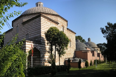
After leaving the Cistern we took a fast tour of thhe Haseki Hurrem Hamami, also called the Baths of Roselana after Sultan Suleyman the Magnificent's wife. They were built by Turkey's most famous architect Sinan for use by  visitors to Haghia Sofia. It is now a shop showcasing carpets from all over Turkey, but retains the original tiles, mosaics, and structure of the hamami--the baths.


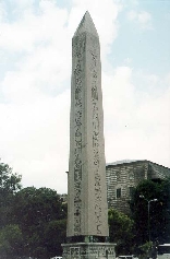
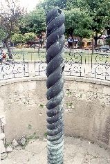
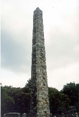
Our next stop was planned to be the Blue Mosque; however, we arrived at prayer time when the mosque is closed to visitors. With about twenty minutes to spend, we decided to visit the famed Hippodrome, once a gigantic stadium that held up to 100,000 people, now a small park surrounded by an oval street that directly follows the line of the chariot racing track. Four notable monuments are situated inside the long oval itself: an Egyptian Obelisk (Dikilitas) built in 1500BC by Tutmosis III before the Temple of Karnak at Heliopolis; the Serpentine Column (Yilanli Sütün) that once adorned the site of the Oracle of Delphi in about 479BC. It once had three serpent heads now in museums.  Also there was the Column of Constantine Porphyrogenitus (Örme Sütün), probably 4th century, and a fountain commemorating the visit of Kaisar Wilhelm II in 1898. The original Hippodrome once held four bronze equestrian statues that we had seen in Piazza San Marco, Venice. Pics are internet. Be sure to click on each one for a larger view.
     
 Egyptian Obelisk   Serpentine Column  Column of Constantine


The Sultan Ahmet Mosque, also known as the Blue Mosque, was finished in 1616. The Blue Mosque takes its name from the blue Iznik tiles decorating its interior. it's considered--rightly--to be one of the grandest buildings inthe world.
We arrived a few minutes early
The marble mihrab was located across the prayer area and was not accessible to visitors; it contains a piece of the ka'ba stone.
                                                                                        (Note:  The image to the right is a thumbnail. Click on it for a spectacular view)


At night from our hotel's terrace we could see seagulls circling its six minarets by twilight and moonlight--a magical scene!
 
 
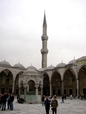
We returned from the Hippodrome just after prayers had concluded though while some kind of lecture was continuing. We passed through a lovely exterior garden into a stone-paved courtyard. In the center of the courtyard was a fountain that Moslum men used to use to ritually wash before entering the mosque for prayers.  As you can see Cindy doing on the left, it is considered respectful for a woman to cover her hair before entering; both  men and women remove their shoes before stepping on the expensive carpeting inside.

 (Both images aresthumbnails. Click on ithem for a larger view)
 
There are six minarets here--unique outside of Mecca and perhaps in all of Islam. The interior of the Blue Mosque is immense--nearly as big as Aya Sofia. It gets its name from the blue Iznik tiles, easily the finest in the world, that decorate the walls. The mihrab is of white marble and contains a piece of the Ka'ba.this may be the most beautiful building we've ever seen.

                                        
                                   (All images are thumbnails. Click on ithem for a larger view) 


We left the Blue Mosque and all its beauty to explore a bit. This was where we met our first carpet salesmen.  They are very common in the tourist areas; well-dressed, friendly gentlemen who will strike up a conversation, mentioning after several minutes chat (which, I might add, often contained useful and interesting local information), that they or their relatives owned a carpet shop and inviting us to visit. Cindy had read much about them--sitting down with a cup of apple tea while the owner and his assistants pulled out various examples of beautiful weaving was something not to be missed.  So we followed the gentleman through Arasta Carsisi, a small bazaar area behind the Blue Mosque, to his uncle's shop.  It was a large and comfortable building, where we were offered the delicious apple tea and a thorough explanation of carpet construction was enjoyed. Sales pressure was high but friendly, with no hard feelings for a refusal. We spent about an hour with two such salesmen, having to politely refuse many other offers at every corner, it seemed!                 
  After leaving for a walk out of Sultanahmet. We headed northwest first, into Eminönü along the Golden Horn, a flooded river that is now an important port. The pic on the left is one Matt took of the busy highway bordering the docks.

After walking through a bustling neighborhood bordering the Spice Bazaar, consisting of alley-sized roads lined stores, shops, people selling on the sidewalk or from every nook, we passed the interesting Tulip Mosque, stopping finally at the old and beautiful Rüstem Paşa Mosque. It was built by Sinan in 1561 for the grand vizier. It was nearly empty save a few men there for prayers, and we wandered freely the ground floor. It was very restful and decorated with beautiful Izmir tiles.

                                          
(These images are not thumbnails.)
 

After leaving Rüstem Paşa Mosque, we went to the Süleymaniye Camii (Mosque), also built by the great architect sinan in about 1557.
The grounds surrounding Süleymaniye Mosque were once home to a hospital, soup kitchen, school, caravanserai, and bath house.  Those buildings are now little shops and restaurants along  dividing streets of Addicts Alley (for the hashish and opium once sold here) located between two sets of walls. It was prayer time when we arrived, so we first wandered the old graveyard, and the mausaleums of Sultan Süleyman and his wife Roxelana. Prayer time must have continued, because, after again doffing our shoes, we were unable to get into the main chamber. Instead we visited a smaller but still impressive chamber to the side where an imam was reading aloud from the Koran.

After leaving Süleymaniye Camii, we strolled through the lush grounds and parklands of Istanbul University, passed the Moorish-style gateway and into Beyazit Square, once part of the Forum of Theodosius. We then walked the few kilometers along Yeniçeriler Caddesi to our hotel. We were out again that evening, eating a fresco at a little outdoor restaurant in the Arasta Carsisi--a small bazaar area behind the Blue Mosque, where Cindy had her first taste of Turkish coffee, a thick, expresso-like (but not expresso-tasting) coffee. We spent about an hour sitting in the park near the Hippodrome from where we had a glorious view of both Haghia Sofia and the Blue Mosque, then to bed.

                                            (All images are thumbnails. Click on them for a larger view)


It was hard to believe we'd seen so much in only our first full day in Turkey, but there was so much more yet to see. Monday's weather was intervals of full sun with clouds.  We'd chosen that morning to visit the famous Topkapi Palace on Seraglio Point, a quarter mile or so from our hotel at the point where the Golden Horn enters the Bosphorus. After our traditional Turkish breakfast, we left our hotel and turned north, strolling past Hagia Sofia and finding ourselves before the Imperial Gate (Bâb-ı Hümâyûn) leading into the palace grounds. Topkapi Palace is actually a complex of pavilions and gardens that housed the Ottoman Sultan, his family, and the government from 1478 until the 19th century; it is now a museum.
We passed the Byzantine church Hagia Irini, crossed the large ourter courtyard-garden, and bought tickets to enter into the main grounds. The outer courtyard is the location of the kitchens, bakeries, carriage stables, and the like, that served the family and staff of the Sultan.

                                                                                                                                                 (This is Cindy outside the Imperial Gate. Click on the thumbnail for a larger view)
We entered the grounds through the large Middle Gate (Orta Kapı); only the sultan was allowed to pass this gate on horseback, and there is still a stone mounting block about midway. It was beautifully decorated, like the rest of the palace, in magnificent tiles, religious inscriptions, and names of the sultans. It is connected to the quarters of some of the eunuchs that were empowered to serve in the harem.
Because of the crowds, we immediately bought a second set of tickets, these would allow us to enter the harem, the personal quarters of the Sultan's family and multiple wives. They were as sumptuous as we expected, with the Iznik tiles we'd learned to expect, thrones, baths, and lounges.
After leaving the harem, we toured the treasury (jewels, kaftans, weapons), library, throne room, and other buildings, as well as took in the lovely view over the Bosphorus and Golden Horn from the gardens.                   (Click on each thumbnail below for a larger view)
The Kubbealti or Imperial council chamber, where the Sultan, Grand Vizier, and other members of council would meet to discuss matters of state. Note the fountain in the middle of the chamber. These stained glass windows decorate the Apartments of the Crown Prince. Though not seen in this picture, the paintwork of the dome was original, The crown prince lived here in seclusion while trained in state administration and to prevent possible seizures of power. Two views from the terrace gardens overlooking Seraglio Point.  The one on the left shows the Golden Horn where it empties into the Bosphorus Straight. The right picture is a shot north up the Bosphorus. the lower half of both pictures shows the old City Walls of Byzantine origin.


After leaving Topkapi Palace, we walked along the scenic Alemdar Caddesi of our first day, and retraced our steps to Eminönü iskele, the ferry docks. We walked past several private and IDO (government run) ferries, having to escape a shoeshine man who literally chased Matt several blocks insisting he get a shine. Following a tip from a website, we chose the tour ferry on the western side of the Galata Bridge run by TurYol, bought our bilet, and took a seat for a trip up the Bosphorus Straight.
The trip was about 1-1/2 hours long. the ferry stayed near enough the shoreline to give us a grand view of palaces, mosques, homes, and history.             (Thumbnails below)
This is a photo looking across the Golden Horn west of the Galata Bridge. In the background you can see the Galata Tower (c.500AD).

Thumbnail
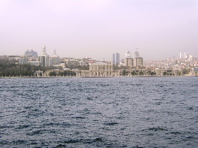
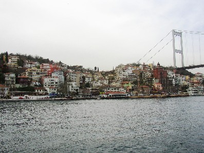
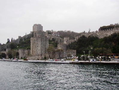
This is Dolmabahçe Palace. It replaced Topkapi as the seat of government after 1856. It may be hard to tell on a photo, but the facade of this palace is over 1/4 mile long! A nice view of the Bosphorus Bridge and the village of Ortakkoy.  Here are two views of the Fortress of Europe, situated on the narrowest point on the  Sosphorus. It was built by Mehmet II in 1452 just before his invasion of Constantinople. The Fortress of Asia, far less preserved, is located on the opposite shore. 


We returned to Eminönü by 2:00 or so, and set off south toward Kapalıçarşı:  The Grand Bazaar. And grand it is!!  Located near Beyazid Square, the Grand Bazaar is a series of small streets covering several city blocks and chock-filled with a wild collaboration of flea markets and small- to medium-sized shops. The whole affair is covered by hundreds of roofs and domes. Though it looks to be haphazzard, things are actually fairly well gridded, and organized pretty much by product.  For example, the streets making up the outer perimeter are gold and jewelry stores, some of the inner grid clothing.  We were especially fascinated by the leather goods section of the bazaar, and the amazing leather and fur coats for sale there.

We wandered freely, finding the ancestral 'nucleus' of Kapalıçarşı--a Byzantine era, brick domed building that was once a warehouse of sorts. According to books, "Kapalıçarşı, today has a surface of 30.7 hectares, 61 streets, 10 wells, 4 fountains, 2 mosques and over 3 thousand shops, managed to claim its present look within 250 years." Talk about every shoppers dream!  To see a bit more of the Grand Bazaar, here is a YouTube link: Grand Bazaar

We left the Grand Bazaar by way of Nuruosmaniye Gate and soon found ourselves again near Beyazid Square. From there we strolled toward our hotel.  Dinner that night was doner kebap, paper thin slices of marinated lamb cut from a tall spit over which it has grilled all day. Served with the ever-fresh Turkish bread, it was delicious!  We returned to the park of the night before to spend more time viewing the magnificent sights of Haghia Sofia and the Blue Mosque, then returned to our hotel and spent several hours chatting and drinking beer with our new friend Ali, who was the night clerk. We turned in tired but satisfied.


It was now Tuesday, time for us to leave Istanbul proper forever. We rose early, had a quick breakfast and checked out of our hotel. Luggage in tow, we walked past the Blue Mosque to the main road and the main tram stop there.  The tram (actually, a trolley) ran every few minutes. We crushed ourselves in with the commuter crowd, then transferred to the Metro (train), until we reached the havilimani, the airport. It was there we were to pick up our rental car, a small Renault hatchback.  From there to the gas station ($10/gallon!) and onto the highway! 
Getting out of the traffic-congested city was a chore, but after a bit we were on the open highway, our goal: Gallipoli! The highway was little different from any American road...in Queens.  But It wasn't until we decided to follow the 'scenic route' (Warning, Will Robinson!) that we learned just what it means to drive in Turkey! 
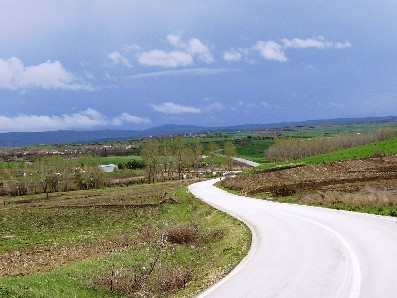
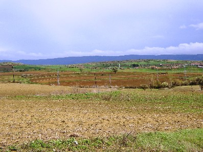
   We followed the Sea of Marmara several kilometers through tiny villages. About a half-hour later, the road went to dirt...make that mud. We were puzzled since it looked to us like a long, bad sheep path.  Then we saw the sheep.  And the shephard. Friendly gentleman. To this day we have absolutely no idea what he meant by either word or gesture when we asked him if this was the road to Sarköy, but we thanked him kindly, drove another kilometer before turning around and rejoining the highway a mile or so from where we left it.  
 

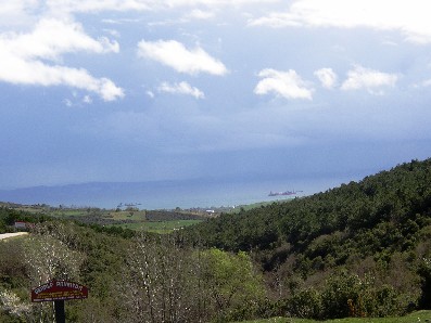
These pictures show the second route we took after leaving the highway; it also took us through a charming countryside filled with olives, fruit, and shephards.o Sarköy.  From there we turned west again and drove until we hit the Aegean Sea, turned south to the Dardenelles, which was called in ancient times, the Hellespont. 

 (Each of these pictures is a Thumbnails. click on them for a bigger view.)
 
After a drive of a bout 6 hours total, we arrived on the Penninsula of Gelibolu (Gallipoli). As any World War I history buff is aware, it was the scene of fierce fighting between the Turks, and a combined Australian and New Zealand Army Corp (ANZAC). the campaign to take the penninsula and eventually Constantinople began on 25 April 1915. It didn't end for 9 months.  When it was over, there were almost half-a-million dead and wounded. Today, the whole penninsula is dotted with cemetaries and battle monuments.

We drove across the peninsula to the Aegean side, stopping first at the closed Kebatepe Information Center. Situated in the hills that make up a large portion of the central peninsula, we had a wide view of the sea, and the landing areas of the Allies. It was only another kilometer to ANZAC Cove, where the Allies came ashore. The waters of the Aegean in March are cold but not frigid. The first picture below shows Matt standing in front of the ANZAC memorial. We crossed the tiny paved road to the ANZAC cemetary, still neatly tended after 90 or so years.  We then began the formal driving tour through the battlegrounds, stopping frequently to tromp through the mud, poke into the trenches, visit several Ally and Turkish cemetaries, and generally learned just how miserable those troops must have been for 9 long months. There are dozens of cemetaries and memorials (61 listed in our guide). We stopped to visit the Lone Pine Cemetary, the Conkbayiri N.Z. Memorial, and others. The largest memorial was the  "Monument to a Fallen Soldier" on the very southern tip of the peninsula; we saw that one from the other side of the Dardenelles. The drive was a bit more than 10 kilometers long. We excited back on the Dardenelles side of the peninsula, a few miles from Eceabat, where we would leave the European side of Turkey by car ferry.

(Click on the thumbnails below to see Matt in front of the sign at ANZAC Cove and in front of the famous "Memorial to a Turkish Soldier, as well as to see one of the trenches.)
     
Matt standing in front of the stone identifying ANZAC Cove.  Matt standing in front of the famous "Memorial to a Turkish Soldier." A fortified trench.  Most of the trenches we saw were simple ditches dug into the clinging and extremely nasty clay. 
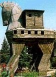
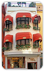
We left the battlegrounds and drove a few kilometers to the little town of  Eceabat, where we could catch the car ferry across the Dardanelles. We disembarked the ferry at the rather famous town of Çanakkale, which was Matt's first time stepping onto Asian soil.  Our hotel was overbooked, so they transferred us a few doors down to their sister hotel, the fabulous Kervansarary Hotel, a historical boutique hotel that was once owned by the Muslim Judge of Canakkale in Ottoman Empire. Also located in Çanakkale's historic 'Clock Square,' it was a beautiful building, richly decorated in crimson and old wood, with an amazing central garden.  We checked in then left in search of food, strolling the popular waterfront area along the straight, watching the ferries, and visiting the giant Trojan Horse made for the movie Troy starring Brad Pitt. The picture to the right shows the horse from the movie.

A quick meal, then back to the hotel and bed, rising and breakfasting early.  Matt had to change a slow leak on our car before we could leave, a process which used up an extra hour or more. Precious time as it would turn out.
We were to see the 'Otel Kervansarary on our return trip.


wooden horse of Troy Seeing the movie horse was only the prelude.  We drove through and then out of the town of Çanakkale, drove the 'Izmir Road' (E-87) south about 30 kilometers, then followed the signs directing us to Troia--Troy!  Immortalized in 'The Iliad' by Homer (whose home was Izmir ((Smyrna)), one of the cities on our trip), the war broke out between the Achaeans and the Trojans circa 1200BC. It lasted, according to legend, 9 years, the Greeks being defeated in battle by the tremendous walls protecting the city.   Excavations revealed 9 full cities one built atop the ruins of the previous. They were designated Troy 1-9 on our walk. Troy 1 was built in the early bronze age (3000-2500BC) and was probably the second oldest site we've ever seen (after Stonehenge). The final city, Troy IX, was Roman, and existed until  about 400AD.

We bought tickets and entered the site, first visiting the fakey wood horse at the entrance.  We climbed inside and got a terrific view of the  archeological site and surrounding area.  At that point we're only 5 kilometers from the Aegean Sea, with sweeping green fields between--fields that had been farmed like this for the last 3,000 years or more. 
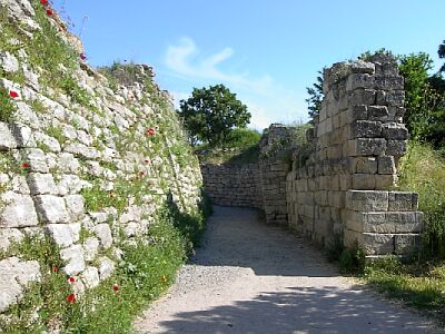
The famous Trojan War was waged with the 7th incranation of the city of Troy, and we could understand how the walls protected the citizens since even the remains of the walls were impressive, a great double set of walls rising high overhead that once protected Paris, Helen, and the other Trojans against Greek Menelaus, Achiles, Agamemnon, and others. 

                                                                                                That's the double-wall of Troy 7 right in an internet picture.


The picture at left is from the internet but it's a great one for showing the levels at which each city was built.
The site was larger than expected, and took us a few hours to go through. We examined a temple dedicated to Athena, a megaron-type house, an odeon (small amphitheater). We even took a quarter-mile hike off the hill to see a water system that piped fresh water into the city wells from a nearby spring. Behramkale


(This is a thumbnails. Click on it for a bigger view.)
Below are some scenes from the digs at ancient Troy. The first is an overview of some of the ruins, which are extensive. The right picture is Cindy standing in front of what was a gate leading into Troy I (2,900BC).                    (These are thumbnails. Click on it for a bigger view.)
Overview of the ruins.  Tower and gate, middle and late bronze age Cindy and the gate to Troy 1. 

 We left Troy about noontime, and followed the Izmir Road for another 45 minutes or so through Ezine. Note the flat Plain of Truva (Troy) and the decent road, as well as the rugged and sometimes-snow-capped mountains in the distance. Those mountains would soon make a big difference in our pleasant drive.


 ←(This is a thumbnail. Click on it for a bigger view.)


We decided to take a brief detour along the "scenic route" (there's those words again!) to historic Assos, located on the Gulf of Edremit (Edremit Korfezi) just about 30 miles east of Edremit itself). It was only about a ten mile detour...on the map.  Little did we know that those ten miles or so involved driving narrow, badly paved roads with an unguarded sheer drop to the distant valley floor on one side. Or that massive tour busses would be using that road at the same time! This was a bit of a harrowing if scenic drive, through a few tiny and ancient villages, through mountainous pasture land, from the inland road to the coast.  The view was breathtaking from the mountain road; click on the thumbnail at right to see the view from the road to the gulf. That's the northern tip of the Greek island of Lesvos (Lesbos) in the distance. Cindy took the first one while standing through the car's sunroof.

The city of Assos, now called Behramkale,  was constructed in 7th century BC, though settled about 2000BC, and was the base Aristotle used to establish his school on philosophy.


                                                                                                                                                     (These are thumbnails. Click on it for a bigger view.) 
 
 
  It took us much longer than expected to get to Assos, so we didn't have time to examine the ruins properly.  The thumbnail at left is a picture we took as we approached the ruins.  We turned around on an also-harrowing downhill road just past the ruins leading to the village on the coast, a few hundred feet below this point.

Though not to be missed, the detour (and earlier flat tire) cost us time. And little did we know, but the road was about to get more difficult.  The volcanic mountain range east of Assos dropped into the sea; therefore, the road cut through the mountains themselves. The road was better than the one to Assos--a normal double-lane road, but with the same sheer dropoff, high percentage of incline, trucks using the road, and hairpin curves.

←      (Click on the thumbnail for a bigger view.)


We drove through Edremit (a major seaside city), turned inland toward Bergama, the large town at the foot of the Pergamum Acropolis. We passed through the town of narrow, alley-sized cobbled streets, shops, and salesmen, past the Red Basilica and up the Acropolis, another narrow, steep road that scared Cindy half to death. We pulled the car into the tiny parking area--no guardrail, 1,000 foot drop to the valley floor.  Cindy was even more terrified, and prayed loudly that no mistakes would happen with either the gear shift or the  breaks!!!

 ←       (Click on the thumbnails for a breathtaking view.) 
The time was now about 4:15. We were told by a gentleman there that we were wasting our 10 Lira entrance fee since the site would be closing soon. We took a few pictures and decided to  return to Pergamum the following afternoon. We gave that same gentleman (shilling carpets, of course!) a lift into Bergama, and he directed us to a government sponsored center that trained Anatolian village women to weave carpets. The gentleman in charge showed us lovely carpets, invited us for a cup of apple tea, and generally made us welcome. We left for Selcuk and Ephesis that evening. 
                                                                                                                                      Click on the thumbnail for a bigger view.) →


The Izmir road now led us south into Izmir (ancient Smyrna), the third largest city in Turkey. It was congested, rush hour, road construction, and traffic jams, and it took us over an hour to get through the city and onto a modern highway for the final hour or so trip from Izmir to Selcuk, a town a couple of kilometers from ancient Ephesis. After arrival, we spent another half-hour driving around Selcuk looking for our hotel, the Hotel Artemis.  This was a thoroughly enjoyable hotel perhaps 5 stories tall, not overly fancy but comfortable. We had dinner in the hotel dining room, trying the local drink raki for the first time. It was anisette based;  you mix it with water and ice and drink it with a meal.


The next morning, Thursday, we visited Ephesis.
Ephesis--one of the three congregations of the Apocalypse that we were able to visit--is considered one of the greatest ruined cities of the ancient world.  A Greek city was first built here in 1000BC, a center for worship of the mother goddess Cybele, though the ruins visited today date from Roman times when Ephesis was a port on the Aegean (the harbor silted up and now lies several kilometers away). it is rumored that the Virgin Mary spent her last days  in Ephesus in a house still located at the foot of the acropolils.  The ruins are extensive and were very crowded during our  visit.                                               
 
  This is the great Library of Celcus that once held 250,000 scrolls to rival the library of Alexandria.  Click on the thumbnail to the left for scale:  You'll see Cindy dressed in black in the lower right corner by a pillar.
  (Click on the thumbnails for a larger view.)  →
         
Palace of the Council  View of upper ruins from top of Odeon  Odeon (small theater
(2nd century AD 
 Palace of the Council (Prytaneion) Baths 
         
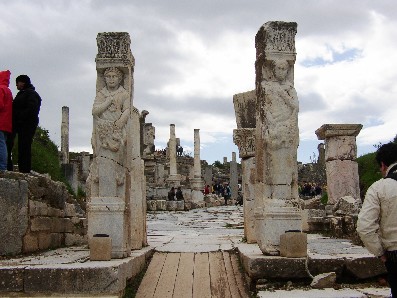
Curetes Street looking toward the Library.  The Gates of Heracles  The "Dumpatorium"
(really called the Latrina) 
Statue of Artemis locked behind a grill in a cavern near the Library. This stadium held up to 25,000 people. It was here the metalworker worshipers of Athena rioted against the Apostle Paul and forced him to leave Ephesus.  
   This is the remains of the Great Temple of Athena, one of the Seven Wonders of the World when it was built in about 500BC; the Apostle Paul preached in this area of the reconstructed temple in the 1st century. It was 377 feet long and 180 feet wide, and built of marble. There's little left now but some foundations that cover several acres, and the single marble column that gives us an idea how huge the building really was.  For a sense of scale, click on the thumbnail at left; that little black shadow at the base of the column is Cindy!

The fortress on the hill is a 6th century Byzantine citadel.
   (Click on the thumbnail for a bigger view.)


We left Ephesis about noon and high-tailed it back to Bergama, the ancient city of Pergamum, arriving in good time. We again ascended 1,000-1,300 vertical feet under many of the ancient city wallsto the acropolis and its guardrail-less little parking lot. We found Pergamum more interesting than Ephesis; the view from nearly anywhere on the hill was spectacular, and parts of it were even older. It was one of the ancient world's centers for learning; the library of 200,000 scrolls was given by Antony to Cleopatra for the library at Alexandria.
We  and entered the grounds and wandered uphill as rain clouds began to gather over the valley.
                                                                                (Click on the thumbnails below for a bigger view.)
We're looking down here on the famous Alter of Zeus, now marked by a large tree.

Remains of the Sanctuary of Athena (c. 200BC)

The two views above are of the Theatre constructed in the 3rd century BC. It has 80 rows of seats and a capacity of 10,000 people. It is considered an engineering marvel, having been hewen from the side of the mountain. It is to date one of the steepest theatres in the world.

The pictures on either side are of the great Temple of Trajan (c. 130AD) near the top of the Acropolis.  Even the ruins are immense.  To get a sense of scale, click on the thumbnail to the right.  You will see Matt standing on the base of the building near one of the columns. 


                              ←      (Click on the thumbnails below for a bigger view.)    → 
 
We left the Acropolis and returned to Bergama, stopping to take some shots of the Red Basilica. It was once a temple to the Egyptian god Serapis built by Hadrian n the early 2nd century, and converted into a church in Byzantine times (4th-5th century) and dedicated to the Apostle John. The building takes its name from the red-brick walls.

                                                                                                              (Click on the thumbnails below for a bigger view.)    → 


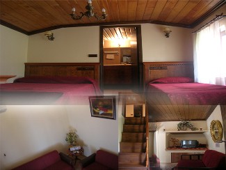
   Having left Pergamum, we drove back that night to Çanakkale.  Again our hotel was full, and we were sent to the wonderful Kervansarary Hotel. This time, they too were almost completely booked; as a courtesy, we were giving the Sultan's Suit at a bargain price of only 40 Euros a night.  This was their premium suite--three stories of comfort. We felt quite overwhelmed!  We're still wondering why the steps leading to the third floor were over a foot high.

These are pictures of the suite.  Luxurious, indeed.  We again strolled the waterfront, then ate in one of the local eateries. Good food, then to bed.

The next day was Friday. We again crossed the beautiful garden to the dining room, had a good Turkish breakfast, and set off north in our rented car. Our destination this time: The Black Sea.


The ferry docks (iskele) was only a few blocks from our hotel. We bought tickets and quickly drove onto the 9:00 ferry to recross the Dardenelles for Thrace--Turkey's European side. Unlike our previous nighttime crossing, the morning ferry gave us some nice if somewhat gray views of the narrowest point of the straight, and it was easy for us to remember the historicity of the area leading back to the battle of Marathon, the Pelopanesian Wars, and World War's I and II. This is the only sea way into the Black Sea and the countries bordering it, which made it a powerful strategic and trade route.  On the dock we met a school group on a field trip.  They were learning english, and were all very sweet and friendly. We all posed for pictures for each other.                                    (Click on the thumbnails below for a bigger view.)
This is the Fortress of Kilitbahir. We could see it lit up at night from Çanakkale. It was a few kilometers south of our disembarkation point. Here are two good views of the narrowest and most historic point of the Dardenelles. This is Eceabat coming up, where we will leave the ferry and turn north up the Gelibolu (Gallipoli) peninsula.  New friends! Kids on a school trip.


It was a long drive north. For about 5 hours we stayed on the main highway rather than using some of the more scenic if harder to travel back roads as we did on our trip south. At Keşan we turned east back through Tekirdağ, finally leaving the motorway at Büyüçekmece, about 50 kilometers from Istanbul. Off the motorway the going was slower, the tarmac roads pothole'd.  As we reached the vicinity of the Black Sea it also became hilly again, taking us through multiple small villages. We left even this road at Durusu and turned onto a very steep backroad, finally emerging into the seaside resort-fishing village of Karaburun.
Karaburun was nestled at the foot of the hills, on a narrow strip adjoining the Black Sea. It was a chilly wind coming off the icy Black Sea, and the water was gray though not violently tossing. We spent time strolling the little fishing marina and beach, driving as far east as we could toward Yeniköy before retracing our trip over the steep hills, back to Durusu, then south.

                                 (Click on the thumbnails below for a bigger view.)


Because of traffic concerns and our rental car, we decided to stay at the Airport Inn Hotel, an upscale hotel in Yeşikoy, about 15 kilometers from Istanbul center but only 3 from the airport. It took us awhile to get to the hotel--rush hour traffic was heavy--but soon we were checking in.  The hotel was located at the Yeşikoy Marina on the Sea of Marmara.  We again spent time strolling the sea front and marina, then ate a far-too-expensive dinner at the hotel, and retired.  We were at the airport by 7 or so the next day. The flight home was uneventful; however, our luggage didn't arrive for 2 weeks!

All in all, we thoroughly enjoyed our trip. The people were nice, the country old and beautiful, and we tasted a part of history. That makes this a great trip!